different use cases
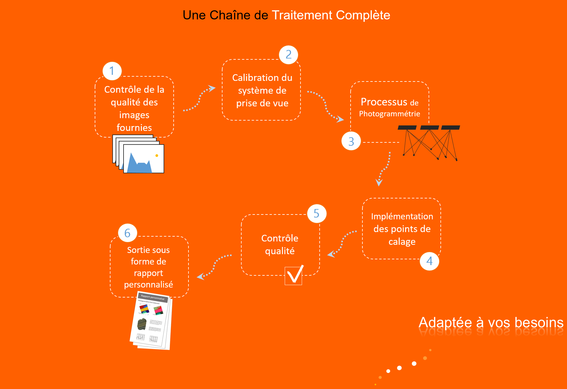
INNOVADRONE offers you a wide range of data processing: Cartography, Photogrammetry, Georeferenced Orthophotos, Cubature Calculation, 3D Modeling, Thermal Orthoplan, Thermal 3D, 3D Technical Inspection, Ortho-Rectified Corridor Mapping, Georeferenced Orthomozaic, Three-Dimensional Models, DEM, Digital Terrain Model, Three-Dimensional Reconstruction, Topographic Plan, GIS, Digital Elevation Model (MNE), Operating Survey, Front Surveys, Stockpile limit, Level curves, Material balance, Point cloud, 3D mesh, Slope, Width and slope of track, Spectrography… Formats: .dted, .asc, .shp, .dwg, etc…
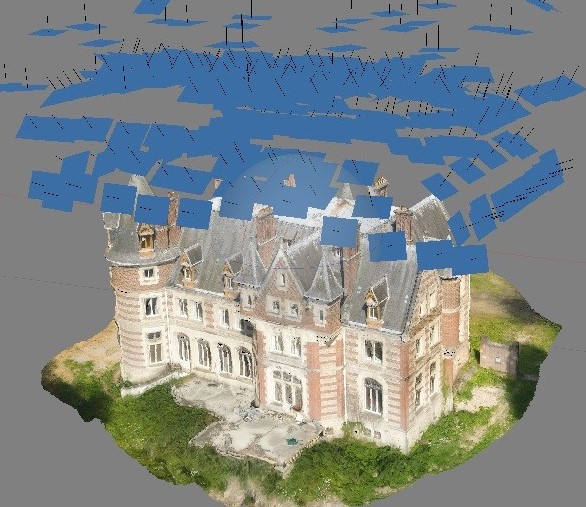
The Post-Processing and Photogrammetry service is a great tool for the diagnosis of buildings, archaeological sites, electrical cables, railways, factories, solar panels and in many other fields such as agriculture or development.